7
GIS and Spatial Ecology
Lab Complete Benthic
Habitat Mapping Project
Brian Walker
, Ph.D., research scientist, and
his GIS and Spatial Ecology lab have recently
completed the Martin County benthic habitat
mapping project. The marine benthic habitats
were mapped to understand the composition
and extent of the coral reef habitat in Martin
County and aid managers in the development
of conservation action strategies.
The data will not only provide new information
on the little-studied benthic community
composition, but also serve as a baseline for
future community shift and range expansion
investigations, assist resource managers in the
development of conservation action strategies,
and enable impact avoidance enforcement.
First, a high-resolution bathymetric LIDAR
survey was conducted in 2008 and 2009. Then,
habitat maps were created by outlining and
defining the features within this survey. Previous
datasets and qualitative ground truthing
data collected using a Seaviewer camera and
DVR at more than 430 sites guided the LIDAR
interpretation. Once the map was completed, a
stratified random accuracy assessment of nearly
200 independent sites showed map accuracies
were estimated to be near 95 percent after
adjusting for known map marginal proportions
(similar to previous regional mapping efforts).
Quantitative ground truthingwas accomplished
after the mapping using SCUBA to provide
valuable information about the composition
of the benthic communities in the mapped
habitats. This was accomplished in August of
2012 with help from the Coral Reef Assessment
and Monitoring lab of
Dave Giliam
, Ph.D.,
assistant professor and Lance Robinson, DSO,
who captained the NSU vessel,
R/V Explorer
.
Four transect lines were run at each of the
16 sites and point intercept, and stony coral
data were collected. During this quantitative
assessment, 553 stony coral colonies were
identified, counted, and measured. Although
The Martin County benthic cover and coral assessment dive team hang out on NSU’s
R/V Explorer
. From left to right: Brian Walker, Ph.D., research scientist; Ari Halperin, M.S.
student; Lance Robinson, OC Harbor Master and Dive Safety Officer; Ian Rodericks, Amanda
Costaregni, Mauricio Lopez-Padierna, and Paola Espitia, M.S. students; Jeff Beal (FWC);
Theresa Robitaille, M.S. student.
An NSU diver collects benthic cover data on
the shallow colonized pavement.
nine species were identified;
Siderastrea
siderea
and
Oculina diffusa
completely
dominated the populations.
The Martin County benthic habitat
morphology was found to be very
different from the morphology of counties
farther south. Unlike other counties, hard-
bottom habitats were sparse outside of a
shallow, near shore area around St. Lucie
Inlet and a few deep ridge lines that taper
or are buried farther north. Large sand
dunes were conspicuous throughout
the county, some of which appear to
be migrating over the deep ridges. The
benthic communities were also very
different, which prompted a proposal
to single out Martin County as its own
Coral Reef Ecosystem Region along the
northern Florida Reef Tract.
The Florida Department of Environmental
Protection—Coral Reef Conservation
Program, Florida Fish and Wildlife
Research Institute, and the National Coral
Reef Institute at Nova Southeastern
University partnered on this project to
expand upon previous mapping efforts in
the Southeast Florida region.
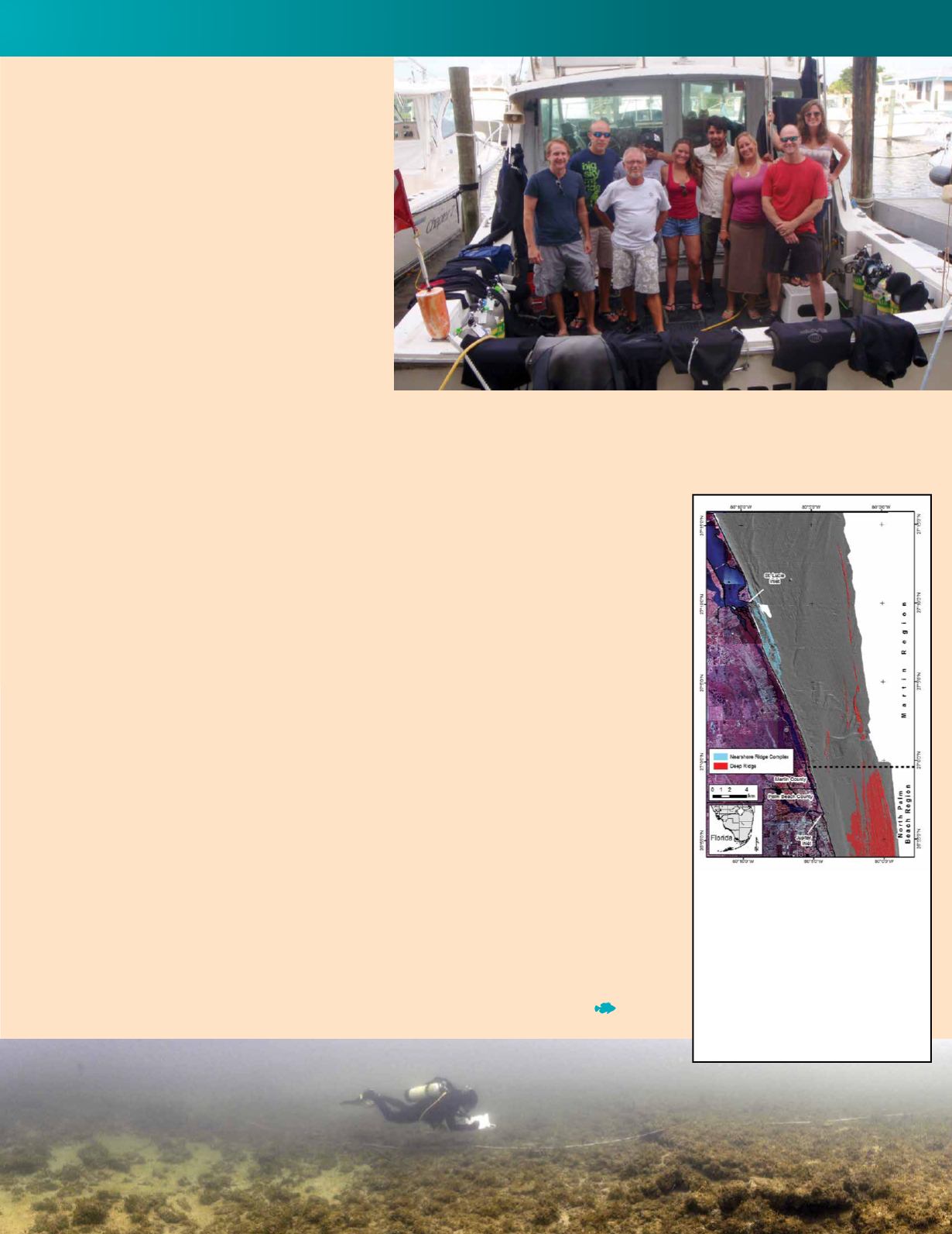
A final habitat map of Martin
County shows the distinct difference
in seafloor morphology fromNorth
Palm Beach County. Analyses of
habitat data coupled with benthic
biologic data revealed Martin
County should be distinguished
as its own Coral Reef Ecosystem
Region. The gray area is hill shaded
topography of sediments.


